
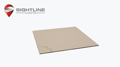
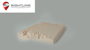
Sightline Maps is changing the way we view topographical mapping data with the help of 3D printing, and on the 8th of September they are launching a Kickstarter. The Californian based company created a web based platform that enables users to create custom 3D models of any area in the world.
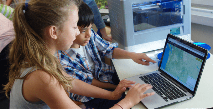
Sightline Maps has many uses; construction, mining, city planning and even extreme sports like mountain climbing, but the most notable is education, and this is the focus of their Kickstarter. Two-dimensional images can explain only so much about the world we live in, so by easily creating 3D printed models students can have a much better learning experience. The aim of the Kickstarter is to get the platform into as many schools as possible. It works with any printer, and any operating system.
“We initially created this software to improve the military’s mission planning capabilities – being Navy veterans – but quickly realized we could have an awesome impact in the classroom when we saw children work with our maps.” said Jason Ray, Operations Manager at Sightline Maps.
“After giving the software to several schools, we realized a few things – 1) They all had great ideas for features that would make the tool better, all of which would cost money to implement, 2) selling to schools is a very challenging sales cycle, 3) we would have to figure out a way to raise money for the features so we can give the software to the schools,” added Ray. “So we came to the Kickstarter platform with the idea that not only will our backers get a really cool color 3D print of a topographical map for supporting us, but every penny they provide will go to sponsoring schools for subscriptions to our software and improving the site.”
For every $100 the Kickstarter raises, one school will receive a year long subscription to Sightline Maps. This includes:
- Immediate access to existing and future features
- Unlimited file downloads for every student and teacher
- Lesson plans designed to support integration of Sightline Maps into existing curriculums
- Direct influence on new feature development
The goal is to bring the platform to 400 schools, the Kickstarter preview page can be viewed here before it goes live on the 8th.
Featured image: Kim Rodriguez and her 5th grade class at Woodin Elementary with the Sightline Maps team. Image: Sightline Maps