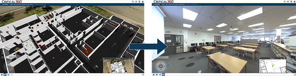
EagleView Technologies measurement company, based in Bothell, WA, are using 3D scanning technology to create digital maps of the inside of buildings. These maps will help emergency services to respond quicker and more effectively in the case of a disaster as they can simulate the quickest ways to get to a given room.
Safeguarding schools and workplaces
A school in Louisville, Kentucky is receiving the company’s Critical 360 3D scanning service for free as a pilot test. Todd Long from EagleView Technologies explains;
If [the emergency services] want to go to classroom five and understand what classroom five looks like, they can just pick one of those images inside there and do a 360 view of the entire area.
For a building of such a size, the service would typically cost between $20,000 & $25,000. The company is looking for funds to help them provide this service to more schools in the area.
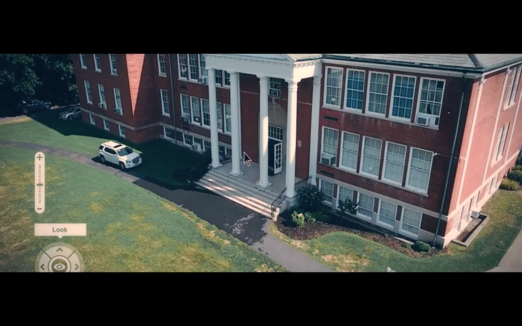
The Critical 360 is also useful for creating images of businesses in the planning process, or in high security buildings for risk assessment.
As seen previously on 3D Printing Industry, the emergency services are one of the key areas cashing in on the benefits of 3D scanning equipment. FARO 3D scanners in particular have been investigated for their crime scene investigation potential, with a FARO Focus 3D Laser Scanner finding a place in the Great Falls Police Department in Montana.
Digital experience of history
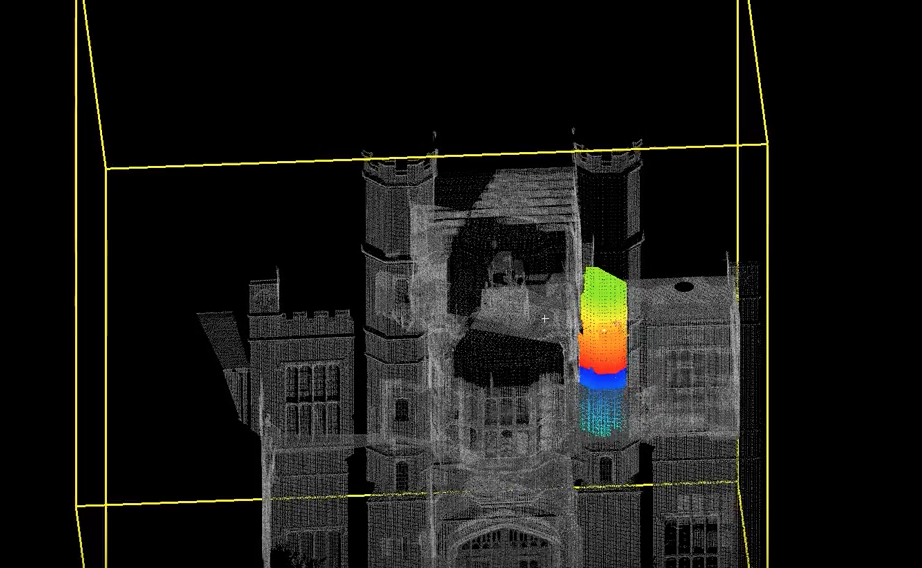
These type of full-room plans are also being used in cultural heritage. In the U.K. ScanLAB Projects is leading such work. The team have created immersive experiences of London’s Sir John Soane’s Museum, the city’s Shipping Galleries, and numerous other places across the globe.
In a recent BBC documentary, the team also used 3D scanning to reveal the secrets hidden beneath Rome, Florence, Naples and Venice. Similarly, the University of Nottingham scanned Tudor country house Coughton Court and found a hidden compartment used by priests to escape in case of an uprising.
As a large-scale 3D scanning service is currently so expensive to perform, it’s inspiring to see more arms of the government and research institutions making use of the technology. In time, the technology is bound to become less expensive. One key cost will perhaps be in the post processing of point-cloud data. Companies such as the Australian company Euclideon are developing the process through an algorithm that effectively “bakes” the clouds into a 3D image, rather than stitching them together in 3D modelling software.
In the same article Paul Tice, 3D scanning specialist and CEO of ToPa 3D visulation and design services, also predicts that point cloud data will eventually be laced with IoT stored metadata, which could prove even more useful to services performed in an emergency.
3D Scanners can be nominated in the 3D Printing Industry Awards here.
Featured image shows an image guiding the emergency services through a Critical 360 3D scan. Screenshot via EagleView on YouTube